| ISAWARE (Increasing Safety through collision Avoidance WARning intEgration) was a project partly funded by the European Community, executed by several companies (airframers, avionics suppliers, airlines), a research laboratory and a university.It was under the supervision of Brite-Euram DGXII "science, research and development" that the project started at 1st February 1998 and took a duration of 36 months. The project focused on the Integrated Situation Awareness System (ISAS) concept, which provided an answer to the "surveillance" aspect of the CNS (Communication, Navigation, Surveillance). | 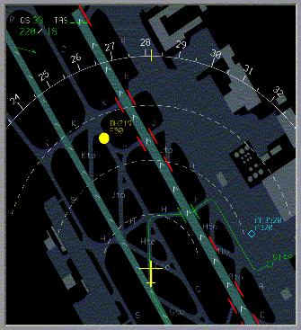 |
The overall objective of the ISAWARE project was to conduct research into the potential improvements to flight safety that were achieved by providing the pilot with a complete predictive situation awareness during all phases of the flight. ISAWARE main objectives were:
- To develop the Integrated Situation Awareness System (ISAS) concept;
- To develop a demonstrator incorporating a part of the full ISAS functionality;
- To evaluate this demonstrator through pilot-in-the-loop simulations.
The Integrated Situational Awareness (ISAS) concept consisted of a new, synthetic displays to enhance situational awareness, combined with a smart sensor data fusion logic to anticipate potential threats earlier than current systems can provide.

 |
ISAS merged data from different safety systems concerning the following data:
|
ISAWARE aimed to give situational awareness of obstacles and terrain. Therefore an obstacle/terrain detection function based on a sensor needed to be specified. Within ISAWARE, the threats were automatically detected, located and provided to the crew in a processed form.Terrain and obstacles were detected by a Terrain Avoidance Warning System (TAWS) model, and depicted on the PFD (Primary Flight Display) and ND (Navigation Display).The basic principle of TAWS was to issue an alert to the flight crew when a combination of values of altitude and vertical speed were inside an envelope. The principle of TAWS relied on :
- Utilization of a terrain data base;
- Determination of an protection envelope ahead of the aircraft;
- Comparison between the protection envelope and the terrain altitude extracted from the terrain data base;
- Accurate determination of the aircraft position and state.
ISAWARE aimed to give situational awareness of traffic (airborne aircraft as well as taxiing aircraft). Therefore a Traffic Collision Avoidance System (TCAS) model was developed. Traffic was presented to the crew on the Navigation Displays (NDs) or, when taxiing, on special taxi-displays.
|
ISAWARE aimed to give situational awareness of weather, for example location of thunderstorms, rain and hail intensities and (possible) wind-shear locations. ISAS provided warnings and alerts concerning wake vortex of other aircraft. Therefore a Weather Radar (WXR) model with wind-shear and wake vortex detection capability was developed. The weather radar model was mainly used to detect and localize various types of atmospheric disturbances and wind-shear events in the area. These disturbances were shown to the crew members on the NDs (Navigation Displays) with different colors; the wind-shear events was located with the help of red and black icons. Specific alerts were provided to the crew with aural annunciations and red or amber messages displayed on the PFD (Primary Flight Display). |
 |
Besides information form TAWS, TCAS and Weather Radar, the ISAS system used information supplied by ADS-B (Automatic Dependent Surveillance -Broadcast) and by SMGCS (Surface Movement Guidance and Control System).
ADS-B
The capability for aircraft to provide aircraft position and other information to airborne and ground based systems is expected to be a part of the future ATS system. ADS-B is a surveillance application, transmitting parameters, such as position, track and ground speed, via a broadcast mode data link for utilization by any air and/or ground users requiring it. On-board aircraft, ADS-B information was displayed on the Navigation Displays.
SMGCS is the term used to describe a modular system consisting of different functionalities to support the safe, orderly and expeditious movement of aircraft and vehicles on aerodromes under all circumstances with respect to traffic density, visibility conditions and complexity of the aerodrome layout, taking into account the demanded capacity under various visibility conditions.
ISAWARE project was jointly developed with the following partners:
- Thomson-CSF DETEXIS;
- Nationaal Lucht-en Ruimtevaartlaboratorium;
- Aérospatiale Matra Airbus;
- Eurocopter;
- BAE Systems;
- Iberia;
- Skysoft;
- Technische Hochshule Darmstadt;
- VDO Luftfahrtgeräte Werk GmbH.
Further information can be found in http://www2.nlr.nl/public/hosted-sites/isaware/index.htm.